Well we walked for five days and ended up back in Lone Pine. Kinda sounds like the beginning of a Graham Parsons song, but we got off the trail at Kearsarge Pass at mile 788 and got a lift into Independence. Unfortunately, we had to hitch back into Lone Pine because all of the 5 motels in Independence were booked due to no hikers leaving because of the weather the past few days.
Sequoia and King's Canyon National Park have been too much for words. It's nice to be able to update the blog because I've been taking more pictures the past few days because every turn you take you end up seeing something even more epic and beautiful than before. We also summited Mount Whitney, the highest peak in the lower 48 states, a few days ago. We can't wait to keep heading north through Kings Canyon and into Yosemite!
Since the PCT joins the John Muir Trail through the Sierras, it's only fitting to include a couple of quotes from Muir himself:
"When we contemplate the whole globe as one great dewdrop, striped and dotted with continents and islands, flying through space with other stars all singing and shining together as one, the whole universe appears as an infinite storm of beauty. "
-
Travels in Alaska by John Muir
"Between every two pine trees there is a door leading to a new way of life."
Muir's marginal note in volume I of Prose Works by Ralph Waldo Emerson
 |
| Cool volcanic tufa rock formations in the Golden Trout Wilderness |
 |
| Dippin' Dots hail |
 |
| Chicken Spring Lake |
 |
| Mountain top meadows abound and are at an elevation of 10,000' |
 |
| Looming weather |
 |
| Crabtree Meadows |
 |
| Timberline Lake on the way up to Whitney |
 |
| Whitney Basin |
 |
| Hitchcock Mountain glowing in the sunrise with Guitar Lake reflecting the clear skies |
 |
| Marmots are all over the high meadows in the sierras. They're like beavers with bushy tails and very curious and unafraid of hikers. |
 |
| Mt Whitney, but that's a false summit there on the left. The real summit is a few hundred feet higher |
 |
| Ice on Hitchcock Lake |
 |
| The last couple of miles of the ascent up Whitney |
 |
| View on the way up |
 |
| Final push |
 |
| The lakes are frozen solid on the north side. |
 |
| The green blotch in the middle is the town of Lone Pine at an elevation of 3727 feet- 10,778 feet lower than the summit |
 |
| The White and Piute Mountains across Owens Valley |
 |
| The hut was built by the CCC as an emergency shelter. |
 |
| The elevation is now officially listed at 14,505' |
 |
| A raven soaring around the peak |
 |
| King's Canyon National Park is behind me |
 |
| Coming back down. Mt Muir is right in front of Ellie |
 |
| Guitar Lake |
 |
| Another Marmot |
 |
| If you look closely you can see a marmot peeking out from near the orangish rock. |
 |
| Pheasant in the trail |
 |
| Whitney in the distance the day after we climbed it. It's the one just to the right of middle with the sides covered in snow |
 |
| Heading up into the Foxtail Pines |
 |
| Bighorn Plateau is above 12,000' elevation |
 |
| Forester Pass is the small notch to the left of the middle of the photo. It's the highest point on the PCT. (Mt Whitney is a side trip off the PCT, so not officially the highest on the PCT) |
 |
| Icy lake near Forester Pass |
 |
| It switched between hail and snow most of the night. |
 |
| Waiting out the storm |
 |
| By morning the precipitation had stopped, but clouds still lingered. |
 |
| The south was clear, but the north where we were going was still socked in with clouds |
 |
| Going up Forester Pass. You can see the trail winding up on the left if you look carefully |
 |
| The view of King's Canyon from the top of Forester. Normally it's a little more spectacular than this, but it still was beautiful in the fast, swirling clouds. |
 |
| The north side of the pass was still covered in snow. Basically you slosh and posthole (when your leg goes down into 2'-3' deep snow) your way 600' down until you're out of the snow and back on the trail |
 |
| Center Peak |
 |
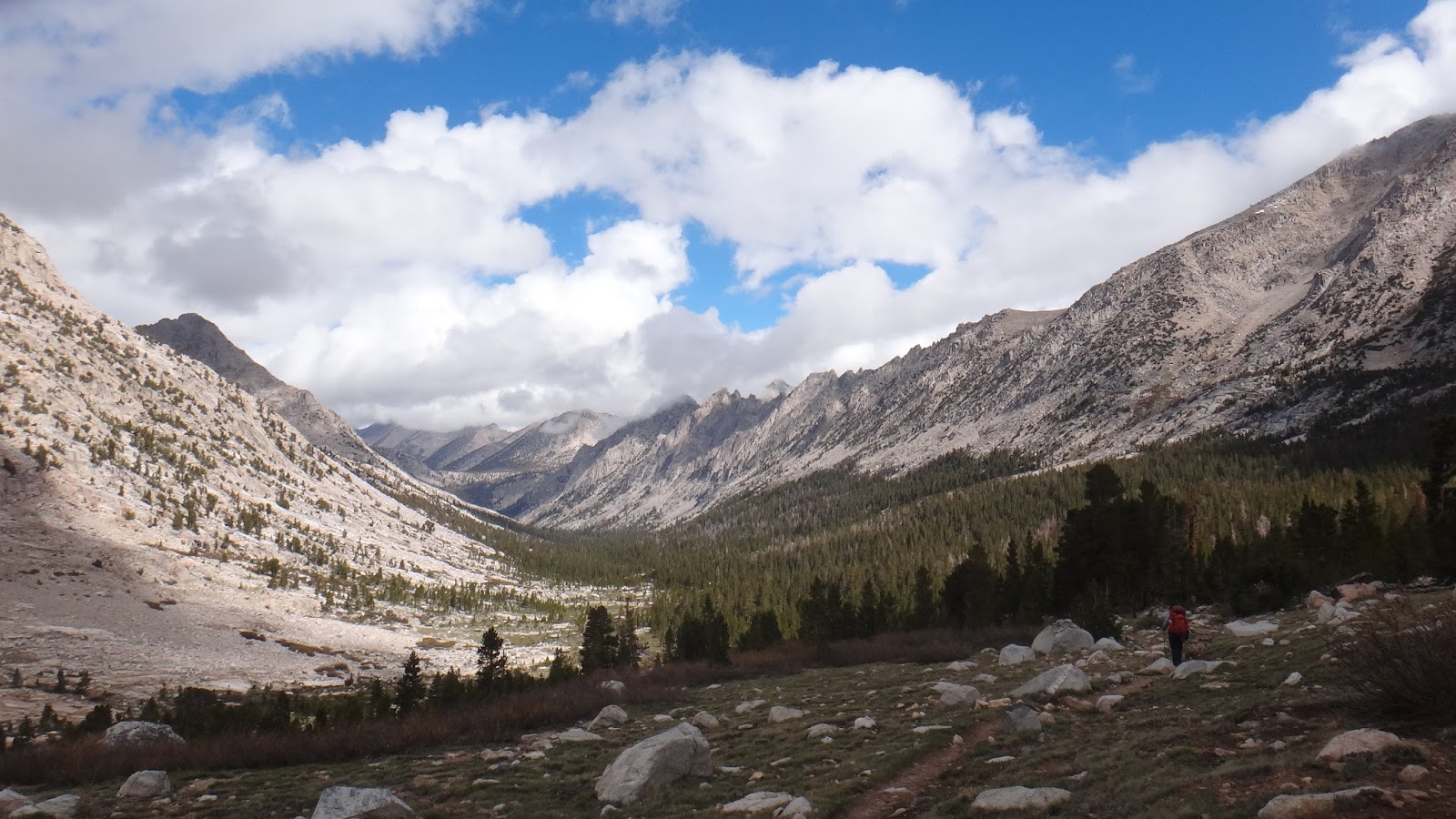
| King's Canyon |
 |
| Getting back to the treeline around 12,000 feet |
 |
| Bubbs Creek. It's amazing not to have to carry more than a liter of water at a time. In the desert, we'd sometimes have to carry up to 6 liters each- that's about 14 pounds! |
 |
| These are only about 3 inches tall and were growing at a really high altitude of about 12,000 feet |
 |
| Vidette Meadows |
 |
| Coming up Kearsarge Pass from Bullfrog Lake |
 |
| The Kearsarge Lakes with the Kearsarge Spires towering thousands of feet behind them |
 |
| Glacial Lake on the other side of Kearsarge |
 |
| Coming down into Independence from the Onion Valley Campground, we watched a thunderstorm move across the Owens Valley desert. You can clearly see where it's raining, and where it's not. It just felt nice to be in a truck after walking through hail and rain for a few hours! |