Pacific Crest Trail
4/17/15- 7/6/15
From the Mexican Border into the Yosemite Valley
4/27/15
About a week ago I turned into an owl. Ellie had fallen asleep
next to me and I was laying looking out of the tent with the rain fly
and door open. The whole of the constellations of the northern sky were
visible above, and only the black silhouettes of the surrounding
mountains and the closest desert scrub plants to the tent could be seen
on the horizon. From my perspective I suddenly took flight and was
soaring above the canyon floor below. I could feel the wind, and see
the manzanitas and chaparral below. Suddenly I sensed the movement of a
lizard and swooped down grasping it firmly in my talons. Then I was
suddenly back in my tent.
This all came about because a
couple hours earlier, we were night hiking with our headlamps when two
eyes were glowing back at me from up the trail. At first I thought it
was a fox, but then it quickly took off in the night air. I then knew
it must have been an owl. Fortunately, it landed a couple hundred yards
further up the trail and let us get within about 5 feet of it. We
stared transfixed at this tiny owl for about twenty seconds until it
took off again, this time not to be seen again. For as brief of an
encounter as it was, it definitely left an impression. That is how it
is everyday out on the trail There is always a new plant, rock, natural
formation, or feature that inspires the deepest of awe. The japanese
call it "yugen"- that wordless state of wonder that makes you feel
completely connected with all of creation.
We're doing great on the trail, and hope everyone reading this is doing great wherever you may be.
Addendum:
I
am shaking and near to tears as I write this. We came straight from
the trail to the library where we used up our hour of computer time to
update our blog. It wasn't until we checked in to a room and turned on
the news after being in a desert without cell reception for 3 days the
we found out was going on. Watching my city plunge into the chaos that
comes about from years of living in fear, subjugation, and poverty is
almost too much to bear. There is no justifying the violence being
perpetrated by a small group of individuals, but anyone who lives in
Baltimore knows that the powder keg of racial tension has been about to
blow. Ellie and I have both taught in the city school-to-prison
pipeline and know firsthand how the kids feel. If only their energy
could be channeled in a different way, real changes could start
happening. Love and understanding must prevail. We pray that this
situation can end in the most peaceful way possible.
 |
| At the border 4/17/15 around 6:30 PM |
 |
| Looking north from the border. |
 |
| PCT Southern Terminus and the border wall between the US and Mexico |
 |
| Fire damage can unfortunately be seen most everywhere. |
 |
| Yucca in bloom. The stalks are usually about 8 feet tall. |
 |
| The
flowers create these green seed pods that eventually dry out and open
to release the seeds. All the while the mother plant is dying- creating
the stalk is the last act of it's life. |
 |
| Hiking down to Lake Morena |
 |
| Campsite on ledge above Kitchen Creek |
 |
| Mid-day siestas can end up looking like a photo shoot with our umbrellas in the bushes for extra shade. |
 |
| Woodpeckers
make holes and hammer acorns into the trees for storage. These suckers
are really in there! We weren't able to even budge one. |
 |
| Trees on Mt Laguna |
 |
| Anza-Borrega Dessert |
 |
| Storm Canyon feeding into the Anza-Borrega |
 |
| Boulder
field campsite. While it was about 90 degrees all day, clouds and
heavy winds moved in that night and it was around freezing with an even
colder windchill. |
 |
| Century plant |
 |
| We're so lucky to see these cactus blooms everywhere everyday. |
 |
| It's steep in the San Jacinto Mountains |
 |
| The Blue Agave shoots are even taller than the Yucca. |
 |
| Great campsite in a ravine on Granite Mountain |
 |
| Barrel Cactus |
 |
| Right
in the middle of this photo is a coyote. Ellie spotted it wandering
from bush to bush in the distance during a lunch break. |
 |
| These are actually relatively clean! |
 |
| Camp at the end of a 23 mile day. We started on Granite Mountain which you can see in the distance on the left, |
 |
| Pastureland leading into Warner Springs |
 |
| Eagle Rock |
 |
| This is as high as Ellie goes. |
 |
| Coyote Melon Blossom |
 |
| We
were walking in the clouds all day coming out of Warner Springs, but it
was good that some much needed rain fell in Southern California. |
 |
| The Manzanita bushes are in bloom. |
 |
| Hikers lining up to get Chicken, Rice, Potatoes, and Tortillas at Mike Herrara's |
 |
| Mike's oldest brother Rudy. The "ornery" one! |
 |
| Steep climb out of Nance Canyon |
 |
| Ellie's favorite color |
 |
| Camp overlooking the small community of Anza. We were awoken by 50-60 mph winds, but the tent performed admirably. |
 |
| Dinner time. |
 |
| One of the many snakes we see day to day |
 |
| Steep canyon walls heading into Idyllwild. |
5/8/15
This dispatch is coming to you from the Best Western at Cajon
Pass at mile 340 of the PCT. We took a day off because of a late season
snow storm that dumped 10"+ in the high mountains ahead of us. Luckily
we shouldn't have to deal with much of the snow because it will melt
off in the next couple of days before we get there.
It's just
another example of the various extremes we've been going through the
past couple of weeks. We've experienced the extreme heat of the 110
degree palm springs desert, and frost in our tent from lows in the upper
20's in the mountains in the morning. There's the extremes of scenery-
mountains made bare by wildfire, and 100 foot tall cedars and pines on
the next ridge over; what seems like every species of desert plants in
colorful bloom; the relentless sun, and the even more relentless El Nino
winds. Yet there is a tranquility that balances everything out and
reminds us daily of how lucky we are to be here.
 |
| Going up the Devils Slide Trail out of Idyllwild |
 |
| Looking out over Idyllwild |
 |
| The beautiful layered bark of the Ponderosa Pine |
 |
| Holes in the boulders and some lingering snow on San Jacinto |
 |
| Looking down into the Palm Springs Desert |
 |
| Interesting rock formations on Fuller Ridge |
 |
| Perched hummingbird |
 |
| Sunset view of San Jacinto from our camp off Fuller Ridge |
 |
| Moonrise over San Jacinto bathed in alpenglow |
 |
| San
Jacinto from the baking desert floor. It was 110 degrees down here and
you can still see snow on the peak. There is a 9,000 foot elevation
difference. |
 |
| Tenting in Ziggy and the Bears front yard with view of San Jacinto |
 |
| The Brontosaurus from Pee Wees Big Adventure in Cabazon! |
 |
| Ziggy and the Bear are retirees who open their backyard to hikers to get out of the intense heat in Cabazon. |
 |
| House rules |
 |
| The Mesa Wind Farm |
 |
| Entering the San Gorgono Wilderness |
 |
| Bullfrog spotted while night hiking |
 |
| San Gorgono Wilderness |
 |
| Entering Mission Creek Canyon |
 |
| San Gorgono Mountain from the San Bernardinos |
 |
| Back of pick-up truck hitch into Big Bear City |
 |
| Big Bear Lake |
 |
| The white sphere is a Solar Observatory. |
 |
| It's a boy! |
 |
| Retiree Nicole who is solo hiking while her husband is on an extended rafting expedition in Alaska! |
 |
| Proper conflict resolution is key on the PCT |
 |
| Deep Creek Gorge |
 |
| Rainbow Bridge over Deep Creek |
 |
| The Silverwood Lake Dam. |
 |
| The sign every hiker wants to see! |
 |
| Trail Angel and 2103 thru-hiker, Legend |
 |
| The chi-chis, I mean, Cajon Pass Best Western |
6/5/15
Wow,
how long it's been! This is the first computer that I've had a chance
to sit in front of since our last update from Cajon Pass. We're now at
mile 750 in a small, desert town called Lone Pine. On the PCT we're
just about to enter Sequoia and King's Canyon National Parks and then
Yosemite. This is the best stuff coming up and it feels like a reward
for making it through the deserts, wildfire-exposed mountains, and
intense sun of Southern California! There are a lot of pictures here so
I don't know what'll crash first- your computer, or your brain...
 |
| Tunnel under RR Tracks in Cajon Pass |
 |
| Train after train rolls by every 45 minutes |
 |
| Snow on some of the highest elevations from the previous days storms |
 |
| We met Jimbo while coming into Wrightwood. He was gardening and invited us to sit and talk. |
 |
| We had to leave when he turned into a koala! |
 |
| Wrightwood Inn |
 |
| Bristlecone Pines. Some in the White Mountain range are 4,000+ years old |
 |
| Snow on Mt Baden-Powell |
 |
| Summit of Baden-Powell |
 |
| Baden-Powell |
 |
| Century Plants |
 |
| High camp on Mt Williamson |
 |
| This is what happens to form the 8-10 foot tall stalks that flower and seed on the agaves. |
 |
| Poodle
Dog Bush- worse than poison oak and all over some of the fire-burned
areas. Luckily we made it through all of those sections without getting
a rash! |
 |
| California City clouded over in the valley below. |
 |
| It was a lot less windy down by the horse corrals at the North Fork Ranger Station |
 |
| I was wearing pants all day and I STILL got this dirty. |
 |
| Rocks formations before Acton |
 |
| Horseshoes at the KOA |
 |
| Tunnel under the Interstate |
 |
| Little did we know it lead to a magical place called "Vasquez Rocks" |
 |
| There were water carved canyons of all different shades of sandstones |
 |
| I think this looks like a gorilla face |
 |
| You can see the people in front of, and the guy on this formation to get a sense of the scale. |
 |
| All of your favorites were shot here, like Wild Wild West starring Will Smith! And look, Jay and Silent Bob Strike Back! |
 |
| Sign coming into Agua Dulce |
 |
| Best pizza on the trail so far, and who can beat a free fountain soda for a thru-hiker?! |
 |
| l to r: Geisha, Rebel Biscuit, Dollywood, KC, and Daniel |
 |
| Yes, that an airplane fuselage that someone is living in outside of Agua Dulce. |
 |
| "The
Oasis" is a few chairs, a water cache, coolers full of various trail
magic, and the random inflatable parrot or palm tree. This happened to
be one of the last days it was going to be up after 14 years because of
complaints from some members of the hiking community. |
 |
| Hanging
out at the Anderson's house, the "Casa de Luna" The Andersons are the
ones who stocked and maintained the Oasis water cache. Their house also
referred to as "Hippie Daycare" |
 |
| Terry laying out the rules for dinner and wielding the yardstick she whacks you with if you break any of the rules in line. |
 |
| Cattle to the trough |
 |
| Her
husband Joe makes pancakes in the morning on two griddles in the
kitchen. Imagine cooking pancakes for around 40 ravished hikers... |
 |
| Rock Inn Lake Hughes |
 |
| That's 4 people, and 5 packs in the back of a ford ranger with a toolbox installed. Ellie got to ride up front with the lady |
 |
| Hikertown is a hostel right before Mojave in the Antelope Valley |
 |
| The owner has built a little wild west style town all over his property and hikers stay in all the different buildings. |
 |
| There are a few roosters, a bunch of hens, and these little guys. |
 |
| The maildrops hikers have sent themselves for re-supply. There was another wall full of packages. |
 |
| Our abode. |
 |
| Aye, aye. |
 |
| There was a rooster that the others were ganging up on, so he preferred hanging out with the hikers in the garage/lounge |
 |
| The LA Aquaduct bringing water all the way from the sierras to the ocean |
 |
| Joshua Trees! |
 |
| Ah, the contrast of the rockies in the Coors billboard, and the Mojave desert. |
 |
| Yanko is from socal who we bump into every couple weeks. |
 |
| Cold and misty coming out of Mojave |
 |
| A carpet of wildflowers growing in a burn area. |
 |
| Only the most scenic lunchspots for us |
 |
| Climbing mountains made of sand really works the calves. |
 |
| Joshua Tree sunset over the Mojave Desert. |
 |
| Abandoned hippie bus in a ravine |
 |
| There is so much sap in some places it looks like dripping wax |
 |
| Mickey (l) and Bob! They were about 2 miles in from the road handing out paydays and heath bars. |
 |
| Check the sign- Mortuary open. This strip mall funeral home is next to an Ace Hardware. |
 |
| Great little place in Lake Isabella. The owners wife made 3 pizzas, potato salad, and 4 pies for dinner! |
 |
| This guy didn't want to move. Good thing he's not poisonous |
 |
| Kennedy Meadows is 700 miles in an important landmark on a hike marking the end of the desert. |
 |
| Incorrect spelling aside, this seems like a pretty cool place to live |
 |
| Hanging out on the General Stores side porch |
 |
| The store runs on a generator because there is no electricity to the town of Inyo |
 |
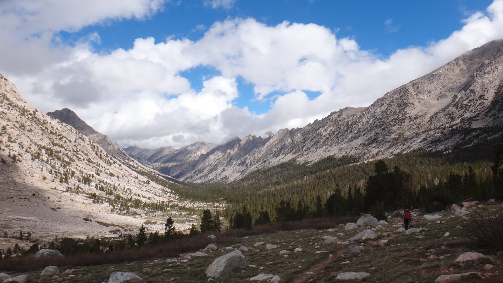
| Heading into the Sierras from Kennedy Meadows |
 |
| Swallow nests under the Kern River Bridge. They were flying in and out feeding their chirping babies during our whole break. |
 |
| Mount Whitney in the distance |
 |
| Twisted trunk at 10,550 feet elevation. |
 |
| Horseshoe Meadows |
 |
| Taking a nice log nap at the campground near the meadows |
 |
| The mountain bluebird |
 |
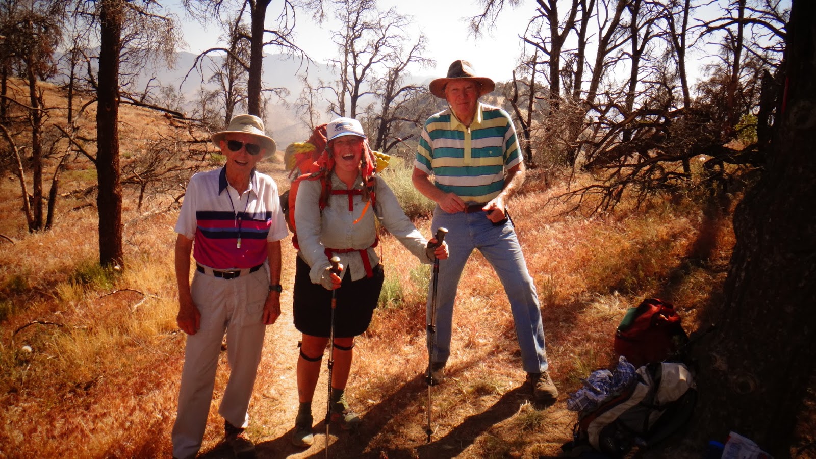
| John
on the left gave us a ride from Horseshoe Meadows down into Lone Pine.
He runs ultra marathons and does nature photography. His
brother-in-law Loren has been hiking and camping with him for 30 years.
Also, I think we're going to change the name of the blog to
"Picturesofelliewitholdmen.blogspot.com |
 |
| Moon setting into the Sierras behind our motel |
 |
| Sunrise Alpenglow on Mt Whitney in the clouds |
 |
| Mural on building in Lone Pine |
 |
| Looks like a Lone Pine twist on the Twin Peaks RR Diner. |
 |
We'll
end with a picture of the guard tower from the Manzanar Internment Camp
where Japanese individuals and families were imprisoned during WWII out
of fear that they'd be spies or terrorist inside of the US. Here's a
quote from Martin Niemöller, a Lutheran minister imprisoned by the Nazis
for his oppostionist views:
"First they came for the Socialists, and I did not speak out—
Because I was not a Socialist.
Then they came for the Trade Unionists, and I did not speak out—
Because I was not a Trade Unionist.
Then they came for the Jews, and I did not speak out—
Because I was not a Jew.
Then they came for me—and there was no one left to speak for me."
This
camp was right next to a town called Independence. We only hope that
love and reason can overtake all the hatred and fear in this world.
6/12/15
Well we walked for five days and ended up back in Lone Pine. Kinda
sounds like the beginning of a Graham Parsons song, but we got off the
trail at Kearsarge Pass at mile 788 and got a lift into Independence.
Unfortunately, we had to hitch back into Lone Pine because all of the 5
motels in Independence were booked due to no hikers leaving because of
the weather the past few days.
Sequoia and King's
Canyon National Park have been too much for words. It's nice to be
able to update the blog because I've been taking more pictures the past
few days because every turn you take you end up seeing something even
more epic and beautiful than before. We also summited Mount Whitney,
the highest peak in the lower 48 states, a few days ago. We can't wait
to keep heading north through Kings Canyon and into Yosemite!
Since the PCT joins the John Muir Trail through the Sierras, it's only fitting to include a couple of quotes from Muir himself:
"When
we contemplate the whole globe as one great dewdrop, striped and
dotted with continents and islands, flying through space with
other stars all singing and shining together as one, the whole
universe appears as an infinite storm of beauty. "
- Travels in Alaska by John Muir
"Between every two pine trees there is a door leading to a new way of life."
Muir's marginal note in volume I of Prose Works by Ralph Waldo Emerson
 |
| Cool volcanic tufa rock formations in the Golden Trout Wilderness |
 |
| Dippin' Dots hail |
 |
| Chicken Spring Lake |
 |
| Mountain top meadows abound and are at an elevation of 10,000' |
 |
| Looming weather |
 |
| Crabtree Meadows |
 |
| Timberline Lake on the way up to Whitney |
 |
| Whitney Basin |
 |
| Hitchcock Mountain glowing in the sunrise with Guitar Lake reflecting the clear skies |
 |
| Marmots
are all over the high meadows in the sierras. They're like beavers
with bushy tails and very curious and unafraid of hikers. |
 |
| Mt Whitney, but that's a false summit there on the left. The real summit is a few hundred feet higher |
 |
| Ice on Hitchcock Lake |
 |
| The last couple of miles of the ascent up Whitney |
 |
| View on the way up |
 |
| Final push |
 |
| The lakes are frozen solid on the north side. |
 |
| The green blotch in the middle is the town of Lone Pine at an elevation of 3727 feet- 10,778 feet lower than the summit |
 |
| The White and Piute Mountains across Owens Valley |
 |
| The hut was built by the CCC as an emergency shelter. |
 |
| The elevation is now officially listed at 14,505' |
 |
| A raven soaring around the peak |
 |
| King's Canyon National Park is behind me |
 |
| Coming back down. Mt Muir is right in front of Ellie |
 |
| Guitar Lake |
 |
| Another Marmot |
 |
| If you look closely you can see a marmot peeking out from near the orangish rock. |
 |
| Pheasant in the trail |
 |
| Whitney in the distance the day after we climbed it. It's the one just to the right of middle with the sides covered in snow |
 |
| Heading up into the Foxtail Pines |
 |
| Bighorn Plateau is above 12,000' elevation |
 |
| Forester
Pass is the small notch to the left of the middle of the photo. It's
the highest point on the PCT. (Mt Whitney is a side trip off the PCT,
so not officially the highest on the PCT) |
 |
| Icy lake near Forester Pass |
 |
| It switched between hail and snow most of the night. |
 |
| Waiting out the storm |
 |
| By morning the precipitation had stopped, but clouds still lingered. |
 |
| The south was clear, but the north where we were going was still socked in with clouds |
 |
| Going up Forester Pass. You can see the trail winding up on the left if you look carefully |
 |
| The
view of King's Canyon from the top of Forester. Normally it's a little
more spectacular than this, but it still was beautiful in the fast,
swirling clouds. |
 |
| The
north side of the pass was still covered in snow. Basically you slosh
and posthole (when your leg goes down into 2'-3' deep snow) your way
600' down until you're out of the snow and back on the trail |
 |
| Center Peak |
 |
| King's Canyon |
 |
| Getting back to the treeline around 12,000 feet |
 |
| Bubbs
Creek. It's amazing not to have to carry more than a liter of water at
a time. In the desert, we'd sometimes have to carry up to 6 liters
each- that's about 14 pounds! |
 |
| These are only about 3 inches tall and were growing at a really high altitude of about 12,000 feet |
 |
| Vidette Meadows |
 |
| Coming up Kearsarge Pass from Bullfrog Lake |
 |
| The Kearsarge Lakes with the Kearsarge Spires towering thousands of feet behind them |
 |
| Glacial Lake on the other side of Kearsarge |
 |
| Coming
down into Independence from the Onion Valley Campground, we watched a
thunderstorm move across the Owens Valley desert. You can clearly see
where it's raining, and where it's not. It just felt nice to be in a
truck after walking through hail and rain for a few hours! |
7/8/15
Here's
another large cache of pictures from the last few weeks. We have
decided to get off of the trail and head back to Baltimore for a while.
We've walked a little over 1,000 miles and have had an amazing time and
we thought a fitting end for our journey would be to finish the John
Muir Trail by heading into Yosemite Valley. Before we finished up in
Yosemite, we ended up renting a car for a few days to do a little road
trip. The main objective was to get some boxes we had sent to South
Lake Tahoe, but a side agenda was to head to Reno and cheap, cheap
casino hotel rooms to allow a sinus infection Ellie had some time to
heal. We're now officially done, but doing one more mini road trip from
Mammoth Lakes down to Vegas! We'll be stopping at a few natural
attractions along the way as we explore the Nevada desert on the way to
LV.
This
following poem is one I read in a small book of Native American poems I
picked up in Bishop and I think it's one of the most fitting ways to
put our trip in perspective.
Eagle Poem
To pray you open your whole self
To sky, to earth, to sun, to moon
To one whole voice that is you.
And know there is more
That you can’t see, can’t hear;
Can’t know except in moments
Steadily growing, and in languages
That aren’t always sound but other
Circles of motion.
Like eagle that Sunday morning
Over Salt River. Circled in blue sky
In wind, swept our hearts clean
With sacred wings.
We see you, see ourselves and know
That we must take the utmost care
And kindness in all things.
Breathe in, knowing we are made of
All this, and breathe, knowing
We are truly blessed because we
Were born, and die soon within a
True circle of motion,
Like eagle rounding out the morning
Inside us.
We pray that it will be done
In beauty.
In beauty.
 |
| View of the Sierras and Mount Williamson from our room at the Independence Inn |
 |
| Old masonic hall turned into a coffee shop |
 |
| Elotes! |
 |
| Dusy Basin |
 |
| Coming over Glen Pass |
 |
| "The Painted Lady" |
 |
| This
is a Pika. It's as big as a mouse, but it's really a small rabbit.
Unfortunately, it will probably go extinct soon because of rising
temperatures. It keeps going higher and higher up the mountains to try
to stay cool, but it's almost to the highest elevations, then they'll
start dying from the heat when they can't go any higher. |
 |
| Rae Lakes |
 |
| Peak reflected in Upper Rae lake |
 |
| This bridge was way wobblier than it looks! |
 |
| Our first campfire of the trail! |
 |
| On top of Pinchot Pass |
 |
| Mule deer strolling |
 |
| One of our favorite camps of the whole trail- the Upper Basin of the King's River. There was no one around for miles |
 |
| Glacial carving |
 |
| Mather Pass |
 |
| Twisted Cedar |
 |
| Buck growing his antlers |
 |
| The deer come so close to camp and are totally not phased by people |
 |
| Some of the last snow we'd see on the trail coming down Bishop Pass |
 |
| Pack trains supply the ranger outposts in the middle of the park. |
 |
| The place that Slim Pickens officially called his "second home"- the Town House Motel in Bishop. |
 |
| Joseph's Bi-Rite cares about the local wildlife. |
 |
| Ascending Muir Pass |
 |
| Muir Hut from below |
 |
| Wanda Lake, named after one of Muir's daughters |
 |
| We sat here for a very long break. |
 |
| Playing uke on Evolution Lake |
 |
| Trout anyone? |
 |
| Campsite over looking Evolution Lake |
 |
| Silver Pass basin |
 |
| Peak
and Half-moon. These jagged types of peaks are called nunataks and are
what stuck out above the glaciers, so while everything else got rounded
off and smooth these stayed sharp and irregular. |
 |
| The BEST marmot! We were only a few feet from him and he splayed himself out on the rock. Maybe he thinks he's hiding... |
 |
| Then he scooted away when we tried to get even closer |
 |
| Remnants of the huge forest fire 12 years ago outside of Red's Meadows |
 |
| Piute influence on the design of the school. |
 |
| No doubt a fine establishment an hour from Reno |
 |
| Our room at the El Dorado had a view of the Bowling Hall of Fame and Arena |
 |
| The coolest motel sign we've seen |
 |
| You're not in the woods anymore, Ellie |
 |
| We know who's in charge at this Reno thrift store. I think this door must open to heaven. |
 |
| Nothing like cruising Reno in a Chevy Spark |
 |
| So cool! |
 |
| Roadcrews are different in California |
 |
| The Panum Crater near Mono Lake is a volcano that erupted about 600 years ago and left this rim and plug as evidence. |
 |
| Tufa rock formations along the shore of Mono Lake. It's actually an inland salt water sea. |
 |
| The Devil's Postpile National Monument |
 |
| It was formed when a field of lava cooled at a uniform rate and made hexagonal columns. |
 |
| Glaciers came and sheered off the sides to expose the formation |
 |
| On top it looks like a tiled floor. The parallel lines are where rocks scrapped across the surface. |
 |
| A friendly group of boy scouts taking up the whole top, but at least you get a sense of the scale. |
 |
| Columns from the side |
 |
| Lupine is one of the most common wildflowers |
 |
| The minarets |
 |
| Rosalie Lake |
 |
| You can see the pollen on the rocks and see how the lake has been slowly draining and evaporating during the summer |
 |
| It rained during the night and our tent left a hexagon just like the devil's postpile |
 |
| Rosalie Lake in the morning |
 |
| Garnet Lake |
 |
| Thousand Island Lake |
 |
| The snow up there is actually the last remaining glacier in Yosemite. |
 |
| Tuolumne Meadows |
 |
| Lembert Dome |
 |
| The
Dude Light and Copper, along with a few other hikers, gave each other
"stick and poke" tattoos on the 4th of July. They say "trail provides."
Hopefully it provides some anti-bacterial lotion so they don't get
infected! |
 |
| Lembert Dome in Tuolumne Meadows |
 |
| Cathedral Peak |
 |
| Heading down into Yosemite Valley |
 |
| first view of half dome |
 |
| Ellie checking out Liberty Cap |
 |
| Nevada Falls plunging down into the valley |
 |
| Half Dome and Liberty Cap |
 |
| The front of Nevada Falls |
 |
| Our
pic at the end of the John Muir Trail. We saw a small sign, and
passed it thinking there must be something grander for the beginning/end
of the JMT. Apparently, that was the official end, but we were good
with taking this picture on the Happy Isles Bridge. |
 |
| "Why the crappy sign, John?" |
 |
| Half Dome in the morning light |
 |
| People pay over a hundred dollars a night in Yosemite Valley to act like they're in the show MASH |
 |
| Stellar Jays like this one are very persistent about trying to get your camp scraps. |
 |
| Yosemite Falls |
 |
| El Capitan stands over 3000 feet above the valley floor. That's 3 times the height of the empire state building. |
 |
| Half Dome from a distance. |
 |
| Tenaya Lake is the largest in Yosemite |
 |
| The road out of Yosemite over Tioga Pass |
7/20/15
Even though we didn't finish the PCT, this trip will definitely be one
we'll never forget, especially because we got engaged!
 |
| The edge of the Ancient Bristlecone Pine Forest- 11,000 elevation |
 |
| The trees in this grove are up to 4,000 years old |
 |
| They grow in acidic soil other pines and plants can't grow in. |
 |
| The tight growth rings make them extremely strong and fire and big-proof. |
 |
| Older parts of the tree die off and new needles only need thin strips of bark to provide them with enough water. |
 |
| Looking out from the grove to the Sierra Nevadas across the Owens Valley |
 |
| Standing dead tree. It may not fall over for another thousand years, then it will lay there for another thousand or so. |
 |
| Female cone. The spikes are why they're called bristlecones. |
 |
| Male cone |
 |
| Stormy Sierra mountains |
 |
| Driving into Death Valley National Park |
 |
| We got to chase this rainbow for an hour before it finally went away |
 |
| It seemed a privilege to see one in a place that only gets 2" of rain a year. |
 |
| Fittingly this spot is called Rainbow Canyon |
 |
| Double rainbow! |
 |
| On the valley floor you could see evidence of the storm that just passed. |
 |
| Everything became even more colorful during the sunset. |
 |
| Sunrise
at the Furnace Creek Campground. We drove until dark before we stopped
in and set up our tent. At 9 pm it had just dropped below 100 degrees |
 |
| Desert breezin' |
 |
| Some
trees around the campground. We pretty much so had the place to
ourselves because believe it or not, summertime is not the prime season
to go to Death Valley- the hottest place in the US. |
 |
| Palm trees in the campground |
 |
| Our rental elantra goes faster than our hiking boots. |
 |
| We were surprised to see cattle egret was on the entrance station to the campground |
 |
| The
Badwater Basin is the lowest point in the US. So on this trip we were
able to go to the highest (Mt Whitney) and lowest elevations in the
country. |
 |
| The sign on the cliff shows where sea level would be. The road is at the bottom of the shot. |
 |
| The middle part is a salt bed, not water. |
 |
| Unintentional self-portrait |
 |
| "The Artist's Palette" |
 |
| Artist's drive |
 |
| Zabriskie Point |
 |
| We looked as hard as we could, but couldn't find anyone naked and rolling in the dust. Film nerds will understand... |
 |
| Gullywashes in the sandstone |
 |
| Amargosa Opera House and Motel |
 |
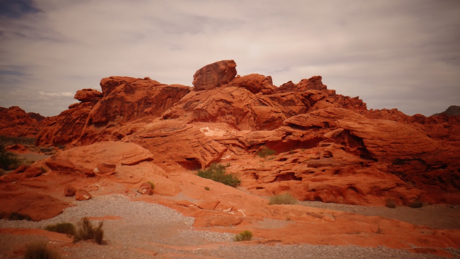
| Entering the Valley of Fire State Park about an hour northeast of Las Vegas |
 |
| The Beehives, Hon. |
 |
| I; pretty sure I sat here about 3,500 years ago too. |
 |
| Atlatl rock- 4000 year old petroglyphs |
 |
| 5 of the 7 Sisters |
 |
| These were built by the CCC in the 30's. |
 |
| Red-Tailed Hawk soaring above the sandstone cliffs |
 |
| Petroglyphs behind the pueblos |
 |
| Petrified Wood |
 |
| Freemont Street, Las Vegas |
 |
| LV seems to have more murals than Baltimore |
 |
| Poppy seeds cure baldness. |
 |
| Not David Lynch themed. |
 |
| The Luxor |
 |
| Trippy cat animation set to The Zombies "She's Not There" |
 |
| Chocolate Meringue bliss |
 |
| "Ladies, are you down with Peaches?" |
 |
| Now we have something to plan besides a hike! |
|


No comments:
Post a Comment